$22.32
Original: $74.40
-70%Delorme North Dakota Atlas & Gazetteer—
$74.40
$22.32The Story
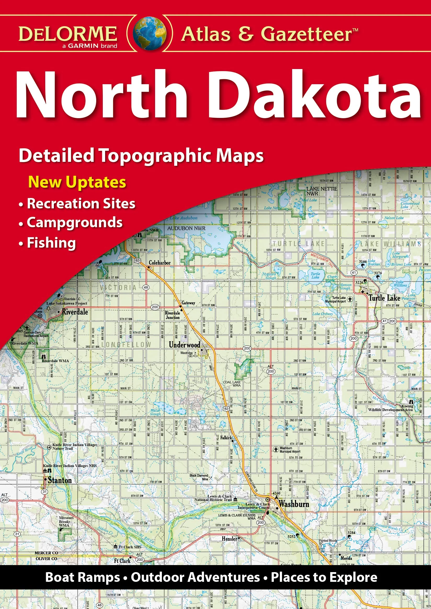
The Perfect Companion for Outdoor Recreation and Trip Planning. With an incredible wealth of detail, DeLorme's Atlas & Gazetteer is the perfect companion for exploring North Dakota. Extensively indexed, full-color topographic maps provide information on everything from cities and towns to historic sites, scenic drives, buttes, ranches, trailheads, boat ramps and even prime fishing spots. Conveniently bound in book form, the Atlas & Gazetteer is your most comprehensive guide to North Dakota's backcountry. Full-color topographic maps provide information on everything from cities and towns to historic sites, scenic drives, recreation areas, trailheads, boat ramps and prime fishing spots. Extensively indexed. Handy latitude/longitude overlay grid for each map allows you to navigate with GPS. Inset maps provided for major cities as well as all state lands. Product Details: North Dakota State Dimensions: 15.5" x 11" AVAILABLE FOR ALL 50 STATES! Rely on DeLorme Atlas & Gazetteers for the utmost in trip planning and backcountry access.
ASIN: 1946494259
VSKU: BVV.1946494259.G
Condition: Good
Author/Artist:Delorme
Binding: Paperback
Note: Any images shown are stock photographs and product may differ from what is shown.
Condition Notes: The item shows wear from consistent use, but it remains in good condition and works perfectly. All pages and cover are intact including the dust cover, if applicable . Spine may show signs of wear. Pages may include limited notes and highlighting. May NOT include discs, access code or other supplemental materials.
Description
The Perfect Companion for Outdoor Recreation and Trip Planning. With an incredible wealth of detail, DeLorme's Atlas & Gazetteer is the perfect companion for exploring North Dakota. Extensively indexed, full-color topographic maps provide information on everything from cities and towns to historic sites, scenic drives, buttes, ranches, trailheads, boat ramps and even prime fishing spots. Conveniently bound in book form, the Atlas & Gazetteer is your most comprehensive guide to North Dakota's backcountry. Full-color topographic maps provide information on everything from cities and towns to historic sites, scenic drives, recreation areas, trailheads, boat ramps and prime fishing spots. Extensively indexed. Handy latitude/longitude overlay grid for each map allows you to navigate with GPS. Inset maps provided for major cities as well as all state lands. Product Details: North Dakota State Dimensions: 15.5" x 11" AVAILABLE FOR ALL 50 STATES! Rely on DeLorme Atlas & Gazetteers for the utmost in trip planning and backcountry access.
ASIN: 1946494259
VSKU: BVV.1946494259.G
Condition: Good
Author/Artist:Delorme
Binding: Paperback
Note: Any images shown are stock photographs and product may differ from what is shown.
Condition Notes: The item shows wear from consistent use, but it remains in good condition and works perfectly. All pages and cover are intact including the dust cover, if applicable . Spine may show signs of wear. Pages may include limited notes and highlighting. May NOT include discs, access code or other supplemental materials.
ASIN: 1946494259
VSKU: BVV.1946494259.G
Condition: Good
Author/Artist:Delorme
Binding: Paperback
Note: Any images shown are stock photographs and product may differ from what is shown.
Condition Notes: The item shows wear from consistent use, but it remains in good condition and works perfectly. All pages and cover are intact including the dust cover, if applicable . Spine may show signs of wear. Pages may include limited notes and highlighting. May NOT include discs, access code or other supplemental materials.